Red palm weevils could arguably be called a global palm tree pandemic. Over the last decade, they have migrated across the globe, laying their eggs in the trees so their larvae can munch on the tree as they grow. The resulting tunnels damage and weaken the trees even causing some trees to break and collapse. The damage to date growers, as well as to palm trees used as decorative features in neighborhoods the world over, is monumental. Moreover, weevils can spread 50 kilometers a day, so early detection is critical.
In just Spain and Italy, pest management and tree replacement will reach 200 million euros in 2023 according to the Food and Agriculture Organization of the United Nations. Weevils can be found in 85 countries and regions worldwide, according to the European and Mediterranean Plant Protection Organization.
To date, the sole method of determining whether weevils have infested a tree has been a visual and acoustic assessment of individual trees. Such a process is laborious – time-consuming and impractical for large-scale municipal monitoring.

Enter Dr. Michael Fire (pictured above) of the Department of Software and Information Systems Engineering and head of the Data4Good lab. Dr. Fire lives in a little town with multiple palm trees on almost every street. In fact, Dr. Fire has one in his front yard. He knew he had one, but the municipality had no record of such a tree, Dr. Fire discovered. The municipality did send someone to spray the tree to prevent it from infection. For most people, that would be the end of the story - my tree protected. But Dr. Fire is not most people.
"I started thinking, what if I could help the municipality by developing a way for them to monitor all of the palm trees?" explains Dr. Fire.
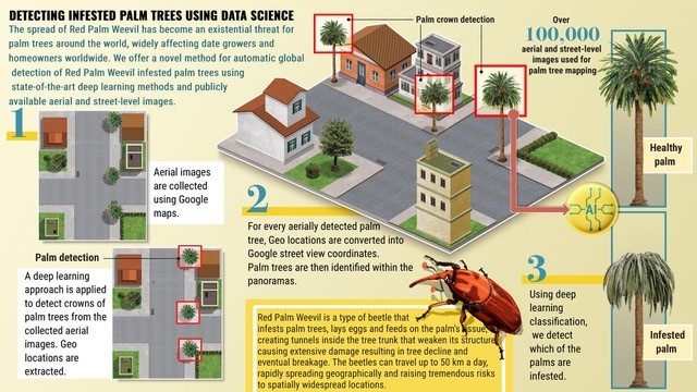
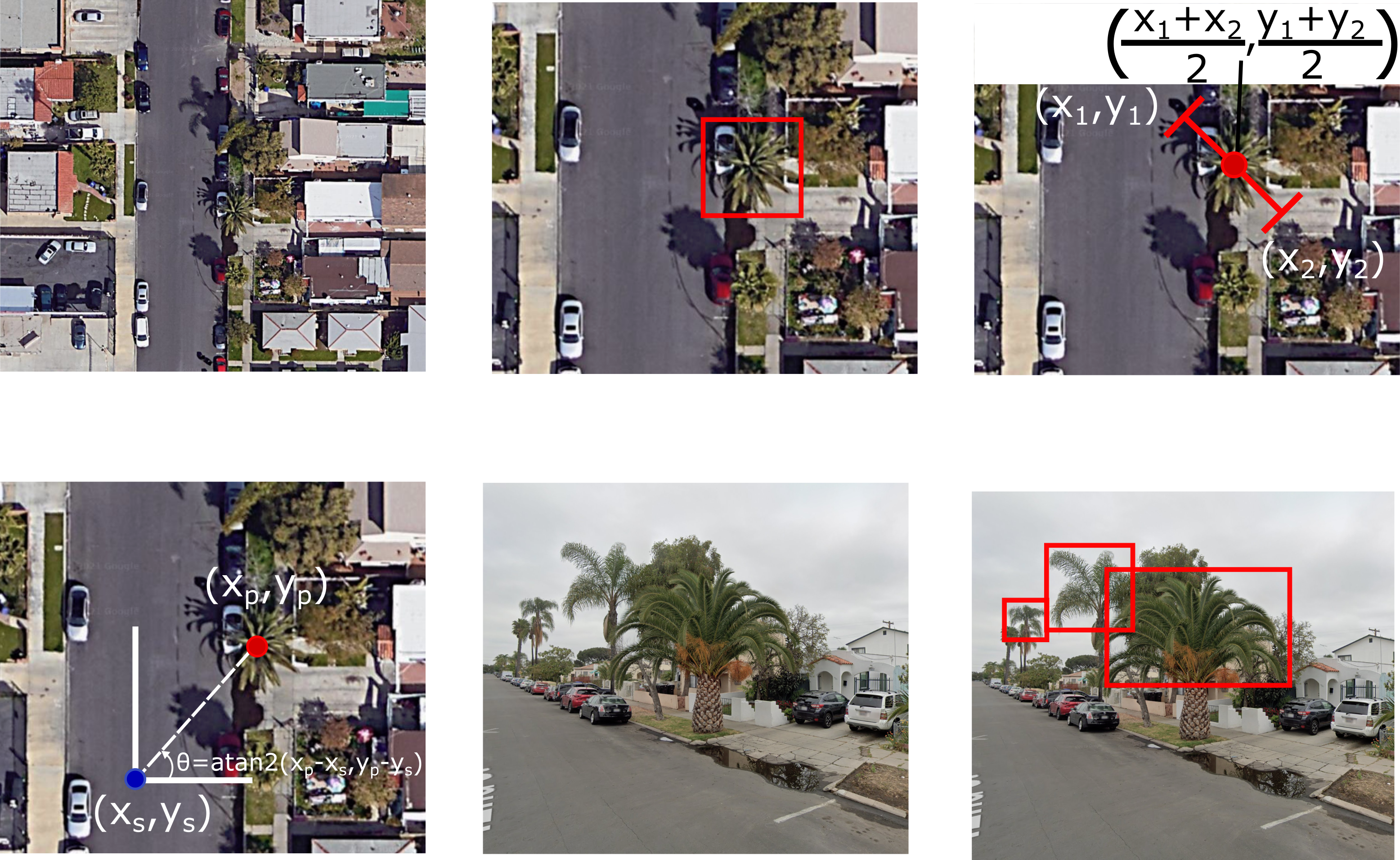
Dr. Fire took his individual tree problem back to his team, Dima Kagan and Dr. Galit Furhmann Alpert, and they devised a global monitoring solution. First, they collected Google aerial and street view images of palm trees. Then, they trained three deep learning models: one to detect palm trees in aerial images, one to detect them in street view images, and a third – an infected palm classifier. They analyzed more than 100,000 images to build their models. They tested their detection system on photos of San Diego, CA because they knew there had been an infestation there in 2016. They were able to find three out of four of the infected trees noted in a study from 2016. They also successfully located trees in Israel and in Miami-Dade County in Florida.
Their findings were uploaded to Arxiv, the pre-print online digital archive.
Their current palm classifier can detect severe and medium infections. Future refinement could lead to earlier detection, the researchers write.

Above: The process

Above: Training the palm tree infestation classifier
Media Coverage:
JPost