In the most recent conflict between Israel and the Gaza Strip, in May 2021, Gazan-launched rockets and incendiary balloons caused multiple fires in the Israeli locales surrounding the Hamas-controlled strip. These fires raged in nature reserves, forests, and farmlands.
A recent study by the Remote Sensing Laboratory at the Jacob Blaustein Institutes for Desert Research (BIDR), Sede Boqer Campus, Ben-Gurion University of the Negev, used an algorithm developed in the lab to determine that some 13,050 dunums (3,260 acres) of land was burned in the recent flare-up, including 7,570 dunams in nature reserves, 3,220 dunams in forests, and 2,260 dunams in farmland.
The algorithm, developed 20 years ago by Prof. Arnon Karnieli, the Director of the Remote Sensing Lab, analyzes satellite images to identify burnt areas. This algorithm, named the AFRI (Aerosol Free Vegetation Index), processes these images to allow researchers to see from space through the surface smoke and distinguish between the active fire, burnt areas, and non-burnt areas. "The spectral signal of green agricultural lands is the same with or without a thick pall of smoke." Karnieli says. "Satellite images taken over several days can differentiate between newly burned land and older damage."
The unique algorithm, developed on the Sede Boqer Campus, has already been adopted by the European Space Agency (EUMETSAT) as a standard tool. Other organizations and ministries in Israel are expected to use it as well in the near future.
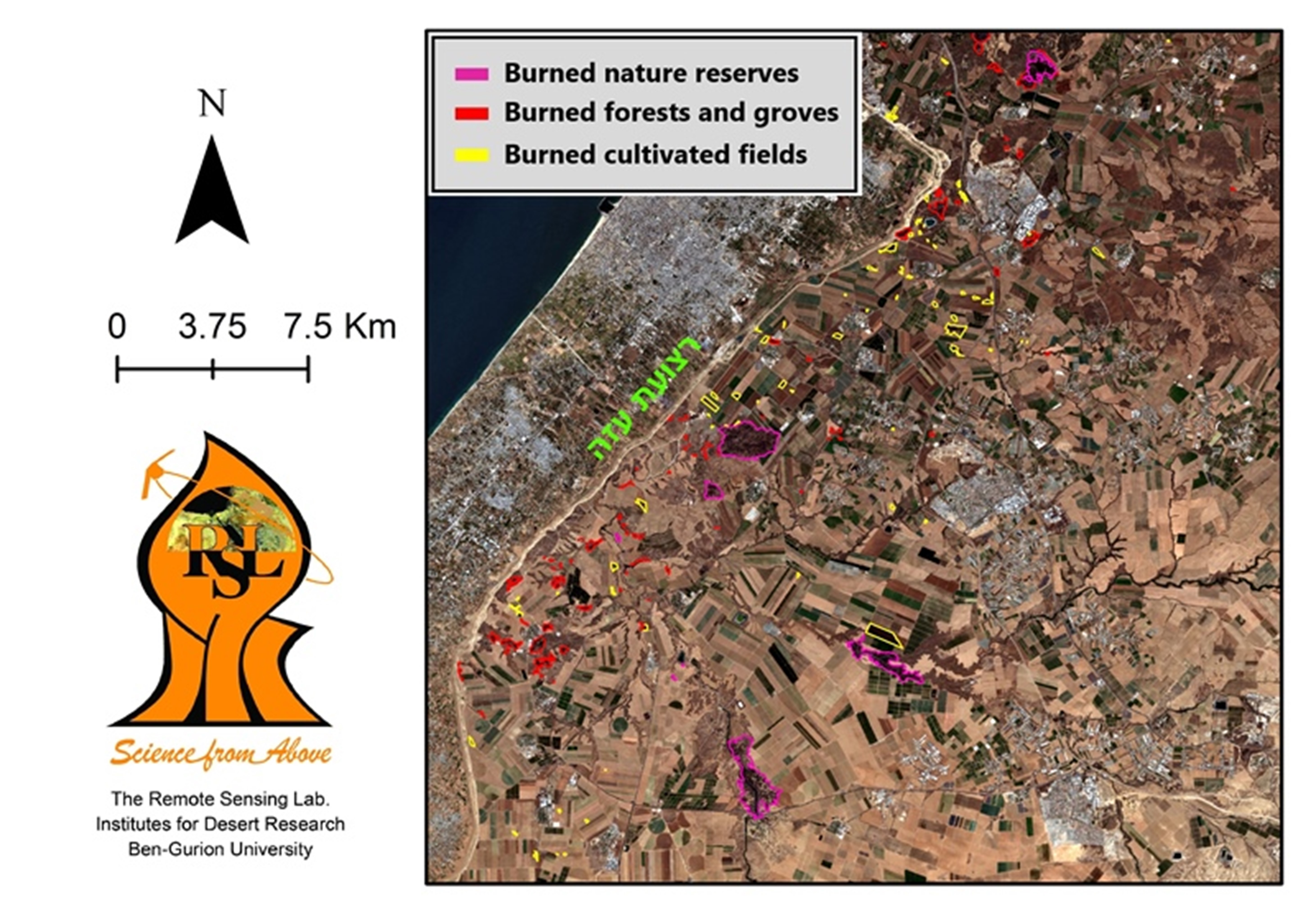
A satellite image of the area surrounding the Gaza Strip, May 2021
